Second Map
(Zekresh Empire)
On the second map:
On the second map, the Imperial Capital City of Zekran is shown as a purple dot with a boundary around it marking the territory associated with it that is not considered part of any province. The Imperial City of Zekran is located at the northeastern end of the straits connecting the Eastern Sea with the Western Sea. Also on the second map, provincial capitals are marked with small red dots.
The small red dot outside the empire is an active volcano and this is the usual meaning of red dots on maps in Nations and Empires. However, there are no active volcanos in the Zekresh Empire so you can be sure that any red dot within the boundaries of the Empire marks the capital city of a province.
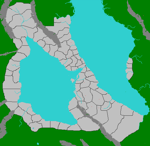
On all maps:
Dark grey masses indicate mountain ranges.
Light blue indicates water and can be lakes, rivers or seas depending on size and shape.
On some maps that have not yet been revealed, dark blue indicates deeper ocean waters.
Light grey marks lands that are part of the Zekresh Empire.
Black lines mark the borders of provinces and nations.
Green indicates lands that are not under imperial control.
Green dots in the sea are islands that are not under imperial control. If they are near a coast controlled by the Empire, the islands are claimed by the Empire, but not under actual Imperial control.
Some mountain valleys are also green or partly green even though they are in the middle of the Empire. This is not a mistake. The green lands are not under imperial control. In the case of mountain valleys, this is generally because they are relatively inaccessible. After there is a player for every province, new players may take the part of leaders of independent enclaves in the green mountain valleys or islands or as the leaders of barbarian tribes beyond the imperial borders.
No comments:
Post a Comment